- Home
- Placer County
Wildfire Mitigation Contractors in Placer County, CA
Placer County in 30 secondsContractors, local rules, where to get help
86 wildfire mitigation contractors are listed for Placer County, 72 with a clear CSLB license.
- Fire hazard zones
- Look up your address
Following Governor Newsom's February 2025 executive order fast-tracking updated statewide maps, Placer County's Board of Supervisors introduced new Fire Hazard Severity Zone designations (moderate, high, and very high) for unincorporated areas in 2025, factoring in vegetation, slope, ember-cast potential, and fire history. These maps apply to Local Responsibility Areas; State Responsibility Area land (most of the county's forested foothill and Tahoe-area terrain) is mapped separately by CAL FIRE.
- Defensible space rules
- Source
County Code Section 9.32, Part 4 (Hazardous Vegetation and Combustible Material Abatement, effective May 21, 2020) mirrors the state's 100-foot defensible space standard but gives local fire officials authority to order abatement beyond 100 feet in extraordinary high-hazard circumstances, and also covers brush abatement on vacant parcels near structures or evacuation roads.
- Chipping
- Source
The Placer County Chipper Program, run by the Placer Resource Conservation District with county and CAL FIRE funding, sends a crew to chip and broadcast piled vegetation for $80/hour; the fee can be waived for low-income households that meet HUD's Very Low Limit. It covers PRCD's service area outside the Tahoe basin.
- Fire Safe Council
- Placer County Fire Safe Alliance
More
Placer County's own Hazardous Vegetation Ordinance (County Code 9.32, Part 4) backs up the state's 100-foot defensible space rule and lets fire officials require clearance beyond 100 feet in extreme-hazard cases. New CAL FIRE Very High severity zones for unincorporated areas were adopted in 2025. Contractors below are ranked by public Google rating.

More in Placer County 76
Serving all of California 8
Also on record 69
-
2c General Engineering
-
Affordable Yard Work (Sierra Land and Yard)
-
Alex the Arborist
-
Alpine Earthmoving
-
Aqua-environs Construction LLC
-
Ar-17 Land & Tree INC
-
Arbor King LLC
-
Arbor Us Tree Service
-
Armstrong Landscape Services INC
-
Artemio's Landscape INC
-
Aspen Grove Landscape
-
Atiles & Sons, LLC
-
B M P Solutions
-
Blackmun Enterprises
-
Boost Landscaping LLC
-
Bushnell Landscape Industries INC
-
Bushwhackers Tree Service
-
California Professional Tree Service
-
Cascading Falls INC
-
Chase Tree Service
-
Demo Patrol
-
Dorer's Professional Tree Care
-
Drone Earthworks
-
Edson Tree Service
-
Elements Tree Service INC
-
Eric's Tree Service
-
Fish Landscape Maintenance
-
Flore's Landscape
-
Foothill Sierra Tree Service
-
Foss Evan
-
Giesen Rowe Tree Service
-
GML Custom Grading
-
Greenleaf Landscape INC
-
Hargo’s Land Management
-
Isidro Ismael Tree Care
-
Jg Landscape Management INC
-
Johnston's Tree Service
-
Junior's Snow Removal & Excavation
-
Just Push It Excavation
-
Lake Tahoe Property Services
-
Landology INC
-
Maguire K A Arboricultural Services
-
Martin's Landscape
-
Mountain Tree Services
-
Neg Landscaping Division
-
Norcal Brush Pros LLC
-
Norcal Tree Management
-
North-cal Landscaping
-
Paradise Landscaping
-
Peregrine Tree Service
-
Props Tree & Landscape Inc
-
Ramoss and Sons Landscaping INC
-
Rivard's Earthworks Inc
-
Rough and Ready Land Management LLC
-
Rs Landworks
-
Sierra Pacific Tree Care INC
-
Sindt Tree Service
-
Spartan Tree Service
-
Sure Shot Forestry
-
Tahoe Tree Care
-
Tenas Landscape
-
Terra, Inc.
-
The Patriot Group
-
Total Landscape Concepts
-
Tree J Arbor INC
-
Tree Pro Tree Service, Inc
-
Widespread Landscape and Maintenance
-
Wildfire Services Group
-
Wildland Tree Specialist
Defensible space rules in Placer County
Fire hazard zones in Placer County
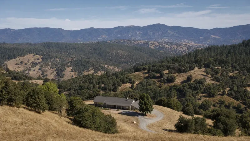
Placer County runs from valley floor cities like Roseville and Lincoln up through Auburn and the Sierra foothills to the Tahoe basin, so fire risk varies sharply by elevation and vegetation. In 2025, the county introduced updated Fire Hazard Severity Zone maps for unincorporated areas, moving to the newer statewide model that accounts for ember cast, slope, and fire history rather than the older maps many areas had used since the 2000s. You can look up any parcel’s current zone on the county’s Fire Hazard Severity Zone page or the interactive FHSZ portal. These county maps cover Local Responsibility Areas only — State Responsibility Area land, which includes most of the forested foothill and Tahoe-area terrain, is mapped directly by CAL FIRE.
Local rules and enforcement
Beyond the state’s 100-foot defensible space requirement (PRC 4291), Placer County’s Hazardous Vegetation and Combustible Material Abatement ordinance (County Code 9.32, Part 4, effective 2020) lets local fire officials order clearance beyond 100 feet where conditions warrant it, and it reaches vacant parcels near homes or roads used for evacuation, not just improved lots. There’s no single county-wide inspection calendar — enforcement is handled by whichever fire district or department covers your property, and a compliance issue is handled through a formal Notice of Violation and Order to Abate rather than a drive-by fine. If you’re near Foresthill or the Tahoe National Forest, keep in mind the 2022 Mosquito Fire, which ignited near Oxbow Reservoir just east of Foresthill and burned nearly 30,000 acres, has kept fuel reduction a priority for fire districts on that side of the county.
Free and low-cost defensible space help
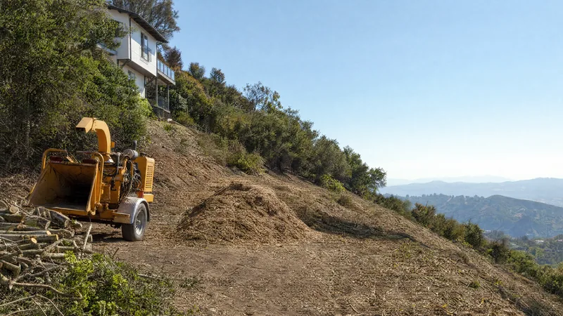
The Placer County Chipper Program, run by the Placer Resource Conservation District with county and CAL FIRE funding, will chip and broadcast a homeowner’s cut brush pile for $80/hour, with fee waivers available for households under HUD’s Very Low Income limit. It covers PRCD’s service area outside the Tahoe Regional Planning Agency boundary; Tahoe-basin residents should check with their local fire district (such as North Tahoe Fire) for chipping services. Eastern Placer homeowners who are low-income seniors or disabled have been served by a separate Defensible Space Fuels Reduction grant funded through the Tahoe Truckee Community Foundation ($175,000 approved in January 2024), but the county has since removed the program’s webpage and the countywide pilot’s funding ran out — check current availability with Placer RCD or the county’s wildfire resources directory before counting on it.
Useful county resources
- Placer County Fire Safe Alliance — the county’s coordinating body working with six local Fire Safe Councils
- Placer County Defensible Space page — zone-by-zone defensible space guidance, including the proposed 0-5 ft ember-resistant Zone 0
- Placer County Hazardous Vegetation ordinance page — full ordinance text and abatement process
Frequently asked questions 5
Who enforces defensible space rules in Placer County?
Enforcement runs through the local fire district or fire department serving the property, not one countywide inspector. If a property doesn't comply, the process starts with a Notice of Violation and Order to Abate, followed by an administrative hearing if the issue isn't resolved. Contact the fire district for your address to ask about a specific inspection.
Does Placer County require more than the state's 100 feet of defensible space?
The baseline matches state law (100 feet under PRC 4291), but County Code 9.32 lets fire officials require abatement beyond 100 feet on a case-by-case basis in extraordinary high-hazard circumstances. The ordinance also applies to vacant, unimproved parcels near homes or access roads, not just properties with a house on them.
Is there help paying for brush and tree removal?
The Placer County Chipper Program charges $80/hour with a low-income waiver option, and a separate Defensible Space Fuels Reduction grant funded by the Tahoe Truckee Community Foundation has covered work for low-income senior and disabled homeowners in eastern Placer County. A related countywide pilot served 60 residents before its funding ran out. The county no longer maintains a page for that grant program, so ask Placer RCD or your local fire district what assistance is currently open.
What changed with the 2025 Fire Hazard Severity Zone update?
Placer County's Board of Supervisors introduced updated moderate/high/very-high zone maps for unincorporated areas in 2025, after a statewide executive order pushed CAL FIRE to refresh maps that in many areas hadn't changed since 2007-2008. Homeowners can look up their parcel's zone on the county's interactive FHSZ viewer.
Does a Very High zone designation affect selling a home in Placer County?
Yes. State law requires sellers to disclose a property's Fire Hazard Severity Zone designation during a real estate transaction (the Natural Hazard Disclosure), and it's grounds for the county's stricter vegetation abatement scrutiny. Buyers and sellers should check the current zone on the county's FHSZ portal before listing or closing, since the 2025 map update moved some parcels into higher categories.